Showing posts with label Zion National Park. Show all posts

Sunday, April 15, 2012

Canyon Country Created Into Jigsaw Puzzles Is Just Perfect


Canyon Country created into jigsaw puzzles is just perfect. Utilising photos of some of the spectacular landscapes of southern Utah, these jigsaws are a delight to put together.

In this CD there are 5 different photos which have been converted to jigsaws of 12, 24, 40, 104 and 260 pieces each, making a total of 25 jigsaw puzzles.


Canyon Country Jigsaw Puzzles CD


This range of puzzles can be used by children of different ages and skill levels, promoting hand and eye coordination. Not only are the jigsaws great for stimulating learning and the imagination, they’re full of colour and loads of fun. You can never lose the pieces.

Jigsaw puzzles are easy to do with the click of a mouse button and can be played over and over. Suitable for adults as well! Each CD costs $25.00. That works out to $1 per jigsaw puzzle - great value!

Puzzles are not printable, they're designed to be used on a computer or laptop or even on a large screen via a data projector, and internet access isn’t required.

They're great to take away on holidays and play in the car while travelling or in the tent, RV or caravan on rainy days.

In the Canyon Country CD there are 5 photos which have been turned into jigsaw puzzles: Bryce Canyon, Red Canyon (near Bryce Canyon), Kolob Canyons in Zion National Park, Mesa Arch in Canyonlands National Park and Dead Horse Point State Park.

The Bryce Canyon photo was taken in the afternoon when the rainy weather had cleared. Blue sky with wisps of cloud above the orange and rusty tones of the canyon. Overnight it poured again so I headed for Cedar Breaks travelling through the Red Canyon (very aptly named too). Rainy weather seemed to follow me so after cloudy skies in Zion National Park I decided to head over to the Kolob Canyons section of the park in the northwest corner. I preferred this because the vistas were in the distance. In Zion Canyon I felt boxed in and had to keep looking up at the canyon walls. At Bryce Canyon you look down into the canyon from the rim and see a beautiful panorama of canyon landforms with mountains in the distance.


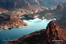
Canyonlands National Park is quite vast and it was very hot when I visited. It had several striking formations, like Mesa Arch. My favourite place though is Dead Horse Point State Park with the Colorado River snaking its way around the bottom of high canyon walls. Camping on the spot gives opportunities for sunset and sunrise photos as well as the photo which I've made into a jigsaw. The place must be quite magical when it's covered in snow.


Here's a bit more about the jigsaws which are also available for sale from my other websites - click here!

Here are a couple of samples (a lion and a bus) so you can see how to do the puzzles -


Canyon Country Jigsaw Puzzles CD


Friday, April 13, 2012

Canyon Country Coming Soon As Jigsaw Puzzles


Utah's Canyon Country is coming soon as 25 interactive Jigsaw Puzzles on CD. The spectacular rock formations present photographers with such a wealth of material that it's hard to resist capturing them on film or digital flash card. The response to my photos has been so overwhelming that I've decided to make 5 of the photos into interactive jigsaws: Bryce Canyon, Zion National Park's Kolob Canyons, Red Canyon, Canyonlands National Park and Dead Horse Point State Park.


Stay tuned!

http://utahparks.blogspot.com.au/2012/04/canyon-country-created-into-jigsaw.html

Friday, October 14, 2011

Photos of Utah's National and State Parks


Many of the visitors to this site are attracted by the photos of Utah's spectacular parks. The following slide presentation puts a few together for your enjoyment of Bryce Canyon, Capitol Reef National Park, Zion National Park, Glen Canyon National Recreation Area and Dead Horse Point State Park.


Check out Canyon Country Jigsaw Puzzles.

Friday, April 22, 2011

Squirrel Stands Up To Snake in Zion National Park, Utah


A hike along the trail in Zion National Park, Utah, led to several discoveries of wildflowers and also wildlife.

Walking in a group may allow for socialising but the noise made by the group can often scare away wildlife and it sometimes drowns out the sounds of nature, like running rivers, bird songs and animal antics.

I'd just left the trail to escape the endless number of noisy hikers and have a closer look at the river and enjoy a bit of peace and quiet. On my way back to join the trail I heard this commotion in a fenced off clearing. I thought it sounded like a rattle (I may have been mistaken though).

However, when I looked closer I saw a squirrel and a snake having a go at each other.


The snake definitely didn't like the squirrel in its patch and there was dust flying everywhere with the squirrel artfully dodging the snake's strike. However, it didn't matter how angry the snake was (click on the photo to zoom in on it), that squirrel was determined to stand its ground even if it meant being bitten.


I took several photos (without tele lens unfortunately) before the snake gave up and retreated from the dust bath created by the squirrel. I've always thought squirrels were cute and quick but this particular one was a feisty little critter as well!

A couple of observations:
  • if you're going to enjoy nature en masse, then keep your eyes and ears open and your mouth shut
  • watch where you're walking (as an Aussie, part of bushwalking is watching out for snakes on the trail anyway)
  • cute and cuddly doesn't necessarily mean weak and lacking courage (perceptions can often be wrong)
  • even if you think you're facing insurmountable odds you can sometimes achieve success through sheer determination

Monday, April 11, 2011

Hike the Trails in Zion National Park , Utah, Using a Great Map


To get the most enjoyment out of hiking in Zion National Park, southern Utah, you need a good map. Check out this one, Zion National Park , UT -Trails Illustrated Map # 214 [Folded Map] from National Geographic.

Click on the ad for more information.


Product Description
Covering all of Zion National Park, our Trails Illustrated map contains detailed topography with shaded relief, up-to-date trails, roads, and points of interest, plus trail summaries and useful information to get the most from your visit.

The North side of the map covers the popular Zion Narrows with a companion hiking timetable, plus Kolob Canyons, La Verkin Creek Trail, Hop Valley Trail, Wildcat Canyon, the West Rim Trail, and more. The South side of the map details the park headquarters, Floor of the Valley Road, East Rim Trail, Telephone Canyon Trail, and the Virgin River.

Printed on durable, waterproof, tear-resistant and environmentally friendly material that will stand up to any outdoor condition. Both sides feature a UTM and Latitude/Longitude grid for use with a GPS, plus compass rose, scale bar and legend for easy interpretation.

Approximately 4 1/4" x 9 1/4" folded; 26" x 38" fully opened
Scale = 1:37,700.

About the Author
Founded in 1915 as the Cartographic Group, the first division of the National Geographic Society, National Geographic Maps has been responsible for illustrating the world around us through the art and science of mapmaking.
Today, National Geographic Maps continues this mission by creating the world's best wall maps, recreation maps, atlases, and globes which inspire people to care about and explore their world. All proceeds from the sale of National Geographic maps go to support the Society s non-profit mission to increase global understanding and promote conservation of our planet through exploration, research, and education.

Sunday, December 12, 2010

Kolossal Kolob Canyons in Zion National Park, Utah


The Kolob Canyons are located in the northwestern part of Zion National Park in southern Utah. They're quite different to Zion Canyon in that their magnificence can be viewed from afar.

If you click on this photo to enlarge, you can actually read the information plaque about the Kolob Canyons.

I did find my patches of blue sky and the pale background just highlighted the coloured rocks.

Unfortunately, I couldn't spend as long as I liked in this section of the park. There are many walks to do and places to explore and some of the wildflowers were out too.

I would love to revisit the Kolob Canyons because there weren't as many people and consequently it's much quieter than Zion Canyon.

There are no camping facilities here either and people probably like the campgrounds which are not too far away from Springdale near the south entrance to Zion National Park.


I preferred this area but it may also have been because the weather was slightly better than the more famous canyon. You can decide yourself when you visit.

If you would like a larger version of the bottom photo for a desktop wallpaper email me at fran@franwest.com.

Read more about the park here http://www.nps.gov/zion


Thursday, December 9, 2010

Zoom in on Zion's Kolossal Kolob Canyons, Utah


Zion National Park, in southern Utah, is a park which is very spread out, having an east entrance and the main south entrance to Zion Canyon. In the northwest there's another entrance leading to the Kolob Canyons. It involves leaving the southern section of the park and heading west on Route 9 and connecting with the I-15. Well worth the drive.


The weather, while I was in the southern part of the park, was overcast and not ideal for photos, so I decided to head to the Kolob Canyons to see if I could find a patch of blue.
Here there was an excellent visitor centre and landscape much more to my liking. Unlike Zion Canyon, where I felt boxed in and had to look up at the rock formations, the Kolob Canyons were more open and easier to photograph in the landscape format (for my DVD purposes).

The location of the visitor centre is a bit deceiving because it doesn't really prepare you for the spectacular views along the road leading into the canyons. More photos of the Kolob Canyons in a future post.

Read more about the park here http://www.nps.gov/zion


Saturday, October 23, 2010

Zion National Park Springs to Life


Zion National Park, Utah, has a novel way of motivating people to drink the natural spring water.

Rather than buy a new bottle of water every time, increasing the landfill problem, people are encouraged to reuse their water bottles at the bottle filling station.

I wish all water drinking fountains looked like this one.

Not only was the background beautiful but the water, cool and fresh from Zion's natural springs, was free!

Hiking is very thirsty work and people were lining up to fill up. I just managed to catch a moment when there was a break in the traffic.


Friday, October 15, 2010

Zion National Park, Utah


Zion National Park, southern Utah, is another one of the state's spectacular parks.

Here you have to leave your car outside the main part of the park, unless you're staying at the Lodge, and catch one of the shuttle buses into the canyon.

A very well run system with plenty of places to stop off and explore.

I spent two nights in the park with different experiences. The first night I slept in the car and awoke to mule deer roaming around the campsite and the next night I spent in the Zion Lodge. Both places also ran an evening ranger talk which was well worth attending to find out a bit more about the park's trails, flora and wildlife.

The photo is the Watchman and the Virgin River. Not a bad photo considering the weather was mostly overcast for my stay.

Read more about the park here http://www.nps.gov/zion