Showing posts with label travel. Show all posts
Wednesday, December 21, 2011
Painters of Utah's Canyons and Deserts
Painters of Utah's Canyons and Deserts [Hardcover], by Donna L. Poulton and Vern G. Swanson looks to be a beautiful and interesting book which has a 4.5 star rating. Check it out.
Editorial Reviews
Review
Painters of Utah's Canyons and Deserts is a welcome addition to any art enthusiast's bookshelf because it gives readers both a historical context and visual progression of the landscape through paintings created by Utah's past and present artists.
(Southwest Art )
This is a tremendous book - almost as big as a canyon itself. It's full of superb paintings and I like the broad selection with its wide appeal. This si much more than a coffee table book, it includes a series of essays giving a background to the painters that have visited and painted this region. Is there anything more wondrous than the canyons of this area? These painters capture the essence of the canyons - the quality of the light, the texture of the rock surfaces, the scale of the magnificent scenery and the colours of the desert and canyon. I have too many favourites to mention them all here. Some of the paintings are breathtaking. I think in this huge selection, there is something for everyone. This is a dramatic book that serves its dramatic subject well.
(Karen Platt www.karenplatt.co.uk/review )
From the Inside Flap
PAINTERS OF UTAH'S CANYONS AND DESERTS
Famous movie director John Ford once emphatically exclaimed, " . . .Monument Valleywasmy greatest star."But long before Ford lionized these great icons, paintings of the sweeping desert and colorful canyon country of Utah's plateau province had captured the popular imagination of American and European audiences.
Contrasts between painters who called Utah home and those who explored and visited. Starting with the rich visual images of Native American petroglyphs, the book then looks at the lively anecdotes of the "artists as explorers," including John Wesley Powell's harrowing trip down the Colorado River, artist Solomon Nunes Carvalho's recovery from the brink of starvation, and artist Richard Kern's death at the hands of the Paiutes. ThomasMoran is prominent in this history with dramatic lithographs and his own exploration of the Zion region.
Love of the western landscape has to do with the capacity of the viewer to experience vast space. To appreciate the desert terrain, one has to be comfortable with an inscrutable universe. Whether existential or spiritual, these themes are evoked in the modern paintings of Maynard Dixon, Conrad Buff, Georgia O'Keeffe, andMax Ernst,who are amongmany visiting artists successfully challenged by this landscape.
Utah artist Alfred Lambourne was the first artist to paint in Zion, and Henry L. A. Culmer was the first to paint the natural bridges. Utah artists recorded the natural beauty of the parks in the 1920s and the stark influence of the Great Depression in the 1930s. Today's modern and traditional artists mix it up, employing classical methods and conventions, often with flagrant juxtapositions, to convey political, existential, or psychological themes. V. Douglas Snow, Gary E. Smith, and Ed Mell are among a growing group of nationally known artists whose work is inspired by the Utah Red Rock.
In all, this is an informative and visually stunning compilation of Art in Utah, detailing its profound influence on western and American culture.
Donna L. Poulton is an Associate Curator of Utah and Western Art at the University of Utah's Museum of Fine Arts. She studied at the Boston University extension in Germany and received her PhD from BrighamYoung University. She has juried and curated many exhibitions, including the Olympic Exhibition of Utah Art. Dr. Poulton has written articles on Utah and Western Art, is the co-author of Utah Art, Utah Artists, and has recently completed a manuscript on Reuben Kirkham, an early Utah pioneer artist. She has taught Utah art history at the University of Utah and has served on the boards of several arts organizations. Dr. Poulton has also filmed extensive interviews with numerous Utah artists, produced commercial videos on Utah art, and consulted with private art collectors and galleries.
Vern G. Swanson is a native of Central Point, Oregon. He graduated from Brigham Young University (BA), University of Utah (MA), and University of London (PhD) in art history. He started his career at the National Gallery of Art in Washington, D.C. (1969-70), taught art and art history at Auburn University as an Assistant Professor (1972-75), and was employed atWasatch Bronzeworks in Lehi (1975-78). Since 1980, Dr. Swanson has been the director of the Springville Museum of Art, has helped the museum's art collection of Utah and Russian art grow, and has contributed toward the construction of a new wing, dedicated in 2004.
Dr. Swanson has published fourteen art history books as sole or joint author. Five of these have been on Utah art, with several in collaborationwith Drs. Robert Olpin,WilliamSeifrit, and Donna Poulton. In 2006, he published a major tome Dynasty of the Holy Grail and in 2007, his third and largest book, Soviet Impressionist Painting. He is now researching for his next two books, "John Hafen: Faithful Artist" and"The Chiasmatic Atonement."
Friday, October 7, 2011
Hike the Trails in Canyonlands National Park , Utah, Using a Great Map
To get the most enjoyment out of hiking in Canyonlands National Park, southern Utah, you need a good map. Check out this one, Canyonlands National Park-Needles/Isle, UT - Trails Illustrated Map # 210 [Folded Map] from National Geographic.
Click on the ad for more information.
Product Description
This map is updated to reflect road closings, new trails, and campground relocation, and includes detailed trail information, points of interest, trailheads, picnic areas, facitlities, and more.
Included on the map are Canyonlands National Park, the Island in the Sky district, the Needles district, and the Maze district. The map also includes the Colorado River, the Green River, Indian Creek Wilderness, Bridger Jack Mesa Wilderness, Butler Wash Wilderness, Canyon Rims Recreation Area, and fascinating information about the park's archaeology. Ideal for recreation activities in this beautiful area, including hiking, biking, camping, climbing, photography--any back-country outdoor activity. Includes UTM grids for use with your GPS unit.
Scale = 1:70,000 Size: 26'' x 38''
About the Author
Founded in 1915 as the Cartographic Group, the first division of the National Geographic Society, National Geographic Maps has been responsible for illustrating the world around us through the art and science of mapmaking.
Today, National Geographic Maps continues this mission by creating the world's best wall maps, recreation maps, atlases, and globes which inspire people to care about and explore their world. All proceeds from the sale of National Geographic maps go to support the Society's non-profit mission to increase global understanding and promote conservation of our planet through exploration, research, and education.
Tuesday, July 26, 2011
Hike and Tour Capitol Reef National Park , Utah, Using a Great Guide
To get the most enjoyment out of hiking and touring in Capitol Reef National Park, southern Utah, you need information from someone who really knows the park. Check out this one, Capitol Reef National Park: The Complete Hiking and Touring Guide [Paperback], by Rick Stinchfield.
Click on the ad for more information.
Product Description
The only complete guide to Capitol Reef National Park whether on foot or from the road.
Finally, the total experience of enjoying Capitol Reef National Park has been captured in one comprehensive volume.
About the Author
Rick Stinchfield, and his wife, Lynne, have spent three months in each of the last six years volunteering and living in Capitol Reef National Park. He is the author or co-author of several articles on mineral collecting, as well as publications on recycling and non-motorized commuting. Rick and Lynne life in Pagosa Springs, Colorado.
Sunday, July 10, 2011
Hike the Trails in Arches National Park, Utah, Using a Great Map
To get the most enjoyment out of hiking in Arches National Park, southern Utah, you need a good map. Check out this one, National Geographic TI00000211 Map Of Arches National Park - Utah from National Geographic.
Click on the ad for more information.
Product Description
This map is updated to reflect road closings, new trails, and campground relocation, and includes detailed trail information, points of interest, trailheads, picnic areas, facilities, and more. Included on the map are Arches National Park, The Highlands, Little Valley, Devils Garden, Lost Spring Canyon Wilderness area, Negro Bill Wilderness area, Scott M. Matheson Wetlands Preserve, Cache Valley, Delicate Arch, Broken Arch, Sand Dune Arch, Pine Tree Arch, Private Arch, Dark Angel, Double Arch, and more. The map also includes the Colorado River, the Windows Section, Petrified Dunes, and fascinating information about the parks geology, archaeology, history, and culture. Includes UTM grids for use with your GPS unit. Approximately 4.25in x 9.25in folded and 27in x 39in fully opened.
Saturday, July 2, 2011
Amazing Arches is Absolutely Awesome
Arches National Park, in southern Utah, USA, is absolutely awe inspiring. So much so that the state has actually put an image of Delicate Arch, located in the park, on vehicle number plates. I'm obviously not the only one gobsmacked by this national park!
It's easy to get to being not that far out of Moab, action capital of Utah. Just take US 191 and travel for about 5 miles north of Moab - a national park situated so close to a major town. How good is that?
After you've picked up your information at the Arches Visitor Center, you then head up the winding road to really enter the park.
Obviously there are many arches in the park to give it its name. You may think a dozen or so but you'd be wrong. Apparently there are over 2,000 arches and they vary considerably in size from something a few feet across to the largest, which is Landscape Arch. This one is 306 feet wide and so skinny too!
Check out the Arches National Park website for further information.
Monday, April 25, 2011
Hike the Trails in Bryce Canyon National Park, Utah, Using a Great Map
To get the most enjoyment out of hiking in Bryce Canyon National Park, southern Utah, you need a good map. Check out this one, Bryce Canyon National Park, UT - Trails Illustrated Map # 219 [Folded Map] from National Geographic.
Click on the ad for more information.
Product Description
The map includes the entire national park area, with detailed trails and topographic information. Also included are portions of Grand Staircase - Escalante National Monument, Bryce Ampitheater, Sunrise Point, Bryce Canyon Lodge, Black Birch Canyon, Rainbow Point, the Queens Garden Trail, and more. Includes UTM grids for use with your GPS unit.
Scale = 1:35,000 Size: 26'' x 38''
About the Author
Founded in 1915 as the Cartographic Group, the first division of the National Geographic Society, National Geographic Maps has been responsible for illustrating the world around us through the art and science of mapmaking.
Today, National Geographic Maps continues this mission by creating the world's best wall maps, recreation maps, atlases, and globes which inspire people to care about and explore their world. All proceeds from the sale of National Geographic maps go to support the Society's non-profit mission to increase global understanding and promote conservation of our planet through exploration, research, and education.
Check out Canyon Country Interactive Jigsaw Puzzles.
Monday, April 11, 2011
Hike the Trails in Zion National Park , Utah, Using a Great Map
To get the most enjoyment out of hiking in Zion National Park, southern Utah, you need a good map. Check out this one, Zion National Park , UT -Trails Illustrated Map # 214 [Folded Map] from National Geographic.
Click on the ad for more information.
Product Description
Covering all of Zion National Park, our Trails Illustrated map contains detailed topography with shaded relief, up-to-date trails, roads, and points of interest, plus trail summaries and useful information to get the most from your visit.
The North side of the map covers the popular Zion Narrows with a companion hiking timetable, plus Kolob Canyons, La Verkin Creek Trail, Hop Valley Trail, Wildcat Canyon, the West Rim Trail, and more. The South side of the map details the park headquarters, Floor of the Valley Road, East Rim Trail, Telephone Canyon Trail, and the Virgin River.
Printed on durable, waterproof, tear-resistant and environmentally friendly material that will stand up to any outdoor condition. Both sides feature a UTM and Latitude/Longitude grid for use with a GPS, plus compass rose, scale bar and legend for easy interpretation.
Approximately 4 1/4" x 9 1/4" folded; 26" x 38" fully opened
Scale = 1:37,700.
About the Author
Founded in 1915 as the Cartographic Group, the first division of the National Geographic Society, National Geographic Maps has been responsible for illustrating the world around us through the art and science of mapmaking.
Today, National Geographic Maps continues this mission by creating the world's best wall maps, recreation maps, atlases, and globes which inspire people to care about and explore their world. All proceeds from the sale of National Geographic maps go to support the Society s non-profit mission to increase global understanding and promote conservation of our planet through exploration, research, and education.
Thursday, December 9, 2010
Zoom in on Zion's Kolossal Kolob Canyons, Utah
Zion National Park, in southern Utah, is a park which is very spread out, having an east entrance and the main south entrance to Zion Canyon. In the northwest there's another entrance leading to the Kolob Canyons. It involves leaving the southern section of the park and heading west on Route 9 and connecting with the I-15. Well worth the drive.
The weather, while I was in the southern part of the park, was overcast and not ideal for photos, so I decided to head to the Kolob Canyons to see if I could find a patch of blue.
Here there was an excellent visitor centre and landscape much more to my liking. Unlike Zion Canyon, where I felt boxed in and had to look up at the rock formations, the Kolob Canyons were more open and easier to photograph in the landscape format (for my DVD purposes).
The location of the visitor centre is a bit deceiving because it doesn't really prepare you for the spectacular views along the road leading into the canyons. More photos of the Kolob Canyons in a future post.
Read more about the park here http://www.nps.gov/zion
Thursday, November 4, 2010
Cruising the Canyons, Lake Powell, Utah/Arizona
One of the many activities to do at Lake Powell, in Glen Canyon National Recreation Area, is to take a cruise around the lake and into the canyons.
Usually there are half day and full day cruises, with lunch provided on the full day ventures. On a hot day, if you choose to be on the top deck, drink plenty of water (provided) and take a hat and sunscreen. Just make sure that the hat ties on because someone on our cruise had to wave his hat goodbye as it blew off into the lake.
As you can see from the photo, the boat is right in the canyon. The cruise captain was just so skilled, he was fantastic.
Before we boarded for our cruise I was eyeing off the nice big boats moored at the jetty and was disappointed when we embarked on our smaller vessel.
However, as we proceeded through the canyons, I soon understood that a smaller vessel was more manoeuvrable. Even so, on one of the cruises, the boat was so close to the canyon wall that one of the loud speakers was smashed. No wonder the captain told us to keep inside the boat area.
Saturday, October 23, 2010
Zion National Park Springs to Life
Zion National Park, Utah, has a novel way of motivating people to drink the natural spring water.
Rather than buy a new bottle of water every time, increasing the landfill problem, people are encouraged to reuse their water bottles at the bottle filling station.
I wish all water drinking fountains looked like this one.Not only was the background beautiful but the water, cool and fresh from Zion's natural springs, was free!
Hiking is very thirsty work and people were lining up to fill up. I just managed to catch a moment when there was a break in the traffic.
Monday, October 18, 2010
Beautiful Bryce Canyon National Park, Utah
In 2009, one of the best holidays I organised myself was a trip to the Southwest of the USA and southern Utah's national parks.
I started in the west with Zion National Park and followed a tourist route recommended on one of the internet sites.
At Zion Canyon, you have to look up to appreciate the canyon, whereas at Bryce Canyon, you have to look down to view a breathtaking panorama.
There are many drives and walks at the top of the canyon as well as walking and mule trails down into the canyon.The features of the park are not only the vegetation and wildlife but in particular the rock formations and their various hues.
Sunrise and sunset are brilliant at certain points of the canyon.
One of the places I'd like to return to and explore a bit more.
Check out http://www.nps.gov/brca/index.htm and Canyon Country Jigsaw Puzzles.
Sunday, October 17, 2010
Houseboat Heaven on Lake Powell, Utah/Arizona
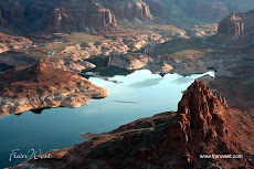
Here's a spectacular view of houseboating on a lake. Not just any lake, but a huge manmade lake, Lake Powell, in Glen Canyon National Recreation Area.

The lake overlaps Arizona and Utah and provides both space and secluded spots in the canyons to find your own piece of Heaven.
I only spent a short time in the southwestern corner of the lake where the houseboat moorings are at Wahweap and Antelope Point.
To say that the area is beautiful is an understatement. The huge cliffs, magnificent rock formations and striations of the canyons are not to be missed at lake level or from the air.
Here's more information.
Saturday, October 16, 2010
Dead Horse Point State Park, Utah
This photo was taken towards evening in Dead Horse Point State Park, Utah, with a storm brewing in the background.
The colours in the rocks are quite mesmerising.
I arrived late in the afternoon and had just enough time to fit in some sightseeing.It was so comforting to find my campsite with my name on the site tag.
Booking my accommodation on the internet before I left Australia was a distinct advantage. It meant I could keep travelling for longer and still be assured of a place at the end of the day.
One day is not enough time here because there's so much to see and do. A spot to return to for sure.
My favourite saying for Utah - "Will someone please turn off the scenery!"
Check out Canyon Country Jigsaw Puzzles.
Thursday, October 14, 2010
Mule Riding in Bryce Canyon National Park, Utah
I missed out on a mule ride down into the Grand Canyon, so I jumped at the chance to go mule riding at Bryce Canyon.
My first time on a mule (a bit scary because I don't like heights) but I was assured that my mule Angie knew what she was doing.
She did, I didn't.
All the mules followed our guide, John Henry, who was on horseback.
We followed the narrow winding trail down into the canyon stopping every now and then for photos and commentary. Spectacular scenery with the various colours of the canyon.I was a bit sore in the backside at the end of the ride and I was definitely walking funny for the rest of the day. Another adventure ticked off the list.
Here's the rest of the story http://pilotyourlife.wordpress.com/2010/04/25/pilot-your-life-7/
Check out Canyon Country Jigsaw Puzzles.
Subscribe to:
Posts (Atom)