Friday, April 22, 2011

Squirrel Stands Up To Snake in Zion National Park, Utah


A hike along the trail in Zion National Park, Utah, led to several discoveries of wildflowers and also wildlife.

Walking in a group may allow for socialising but the noise made by the group can often scare away wildlife and it sometimes drowns out the sounds of nature, like running rivers, bird songs and animal antics.

I'd just left the trail to escape the endless number of noisy hikers and have a closer look at the river and enjoy a bit of peace and quiet. On my way back to join the trail I heard this commotion in a fenced off clearing. I thought it sounded like a rattle (I may have been mistaken though).

However, when I looked closer I saw a squirrel and a snake having a go at each other.


The snake definitely didn't like the squirrel in its patch and there was dust flying everywhere with the squirrel artfully dodging the snake's strike. However, it didn't matter how angry the snake was (click on the photo to zoom in on it), that squirrel was determined to stand its ground even if it meant being bitten.


I took several photos (without tele lens unfortunately) before the snake gave up and retreated from the dust bath created by the squirrel. I've always thought squirrels were cute and quick but this particular one was a feisty little critter as well!

A couple of observations:
  • if you're going to enjoy nature en masse, then keep your eyes and ears open and your mouth shut
  • watch where you're walking (as an Aussie, part of bushwalking is watching out for snakes on the trail anyway)
  • cute and cuddly doesn't necessarily mean weak and lacking courage (perceptions can often be wrong)
  • even if you think you're facing insurmountable odds you can sometimes achieve success through sheer determination

Monday, April 11, 2011

Hike the Trails in Zion National Park , Utah, Using a Great Map


To get the most enjoyment out of hiking in Zion National Park, southern Utah, you need a good map. Check out this one, Zion National Park , UT -Trails Illustrated Map # 214 [Folded Map] from National Geographic.

Click on the ad for more information.


Product Description
Covering all of Zion National Park, our Trails Illustrated map contains detailed topography with shaded relief, up-to-date trails, roads, and points of interest, plus trail summaries and useful information to get the most from your visit.

The North side of the map covers the popular Zion Narrows with a companion hiking timetable, plus Kolob Canyons, La Verkin Creek Trail, Hop Valley Trail, Wildcat Canyon, the West Rim Trail, and more. The South side of the map details the park headquarters, Floor of the Valley Road, East Rim Trail, Telephone Canyon Trail, and the Virgin River.

Printed on durable, waterproof, tear-resistant and environmentally friendly material that will stand up to any outdoor condition. Both sides feature a UTM and Latitude/Longitude grid for use with a GPS, plus compass rose, scale bar and legend for easy interpretation.

Approximately 4 1/4" x 9 1/4" folded; 26" x 38" fully opened
Scale = 1:37,700.

About the Author
Founded in 1915 as the Cartographic Group, the first division of the National Geographic Society, National Geographic Maps has been responsible for illustrating the world around us through the art and science of mapmaking.
Today, National Geographic Maps continues this mission by creating the world's best wall maps, recreation maps, atlases, and globes which inspire people to care about and explore their world. All proceeds from the sale of National Geographic maps go to support the Society s non-profit mission to increase global understanding and promote conservation of our planet through exploration, research, and education.

Monday, March 14, 2011

Flyabout to Rainbow Bridge over Lake Powell, Utah/Arizona


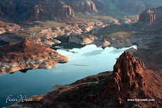
Rainbow Bridge National Monument, Utah, can be reached by boat, on foot or on horseback but my preferred method of viewing is from the air.

I got up very early to go on a scenic flight at 6am while the sun was rising. We took off from Page Airport and headed over Lake Powell and Glen Canyon National Recreational Area. It's better to go flying early in the morning when it's cooler and generally calmer. The light is quite intriguing as well.


Rainbow Bridge is the largest natural bridge in the world at 290 feet tall and 270 feet across (about 90 metres) and is considered sacred by the Navajo Indians.

When viewed from the ground Rainbow Bridge looks as though it's in the open but from the air you can see that it's tucked away amongst the rocks. Zoom in on the photo so you can see the top part of the bridge in the bottom right foreground.


Fortunately there's no visitor centre on the ground to degrade the spirituality of the place.

After my flight I headed back to Wahweap to catch a day cruise which took us over the large expanse of the lake, into some of the canyons, and to Rainbow Bridge itself. It was a short hike from the jetty but on such a hot day a hat, sunscreen and plenty of water were essential.

This is one place to put on your bucket list but see it from both the ground and the air like I did.

For further information check out Rainbow Bridge National Monument and Glen Canyon National Recreational Area.

Friday, February 11, 2011

Colossal Canyonlands Totally Awes Visitors


The title says it all. Canyonlands National Park is Utah's largest national park and it's colossal. There's mile upon mile of canyons and rockscapes and the state's slogan "Utah Rocks" is a very apt description.

This national park isn't that far from Moab, adventure capital of Utah (it reminds me a bit of New Zealand's Queenstown). There are two sections to the park, Island in the Sky, the northermost area of the park, and the Needles District, in the southernmost section, closer to Monticello.

I didn't have enough time in the southern part but the drive in was absolutely beautiful.

More time was spent in the Island in the Sky section with quite a few different landforms to stop and explore. For a quick visit to the park, you can get to the main attractions by paved road. Then there's the really rugged off road stuff for 4 wheel drives. Hiking, climbing, mountain biking and rafting are other activities to do if you plan to stay a while.

The main paved road ends at the Grand View Point Overlook. That name is an understatement, much like saying the Grand Canyon is grand. You can see canyon after canyon fading into the distance.

I took this photo more for the actual lookout with the piles of wood bordering the path than the scenery. However, if you zoom in on the photo you'll still get some idea of the canyons in the distance. I'll do more posts later to show some of the park's other beauty spots.

When I was in the park it was very hot, so I had on my trusty Akubra hat, sunscreen on my face and arms, and lots of water in the backpack. All essential when you go hiking in the Outback or Utah's desert country.

Check out Canyonlands National Park site for more information.

This might interest you too. Click on the ad for more information.


Sunday, December 12, 2010

Kolossal Kolob Canyons in Zion National Park, Utah


The Kolob Canyons are located in the northwestern part of Zion National Park in southern Utah. They're quite different to Zion Canyon in that their magnificence can be viewed from afar.

If you click on this photo to enlarge, you can actually read the information plaque about the Kolob Canyons.

I did find my patches of blue sky and the pale background just highlighted the coloured rocks.

Unfortunately, I couldn't spend as long as I liked in this section of the park. There are many walks to do and places to explore and some of the wildflowers were out too.

I would love to revisit the Kolob Canyons because there weren't as many people and consequently it's much quieter than Zion Canyon.

There are no camping facilities here either and people probably like the campgrounds which are not too far away from Springdale near the south entrance to Zion National Park.


I preferred this area but it may also have been because the weather was slightly better than the more famous canyon. You can decide yourself when you visit.

If you would like a larger version of the bottom photo for a desktop wallpaper email me at fran@franwest.com.

Read more about the park here http://www.nps.gov/zion


Thursday, December 9, 2010

Zoom in on Zion's Kolossal Kolob Canyons, Utah


Zion National Park, in southern Utah, is a park which is very spread out, having an east entrance and the main south entrance to Zion Canyon. In the northwest there's another entrance leading to the Kolob Canyons. It involves leaving the southern section of the park and heading west on Route 9 and connecting with the I-15. Well worth the drive.


The weather, while I was in the southern part of the park, was overcast and not ideal for photos, so I decided to head to the Kolob Canyons to see if I could find a patch of blue.
Here there was an excellent visitor centre and landscape much more to my liking. Unlike Zion Canyon, where I felt boxed in and had to look up at the rock formations, the Kolob Canyons were more open and easier to photograph in the landscape format (for my DVD purposes).

The location of the visitor centre is a bit deceiving because it doesn't really prepare you for the spectacular views along the road leading into the canyons. More photos of the Kolob Canyons in a future post.

Read more about the park here http://www.nps.gov/zion


Thursday, November 4, 2010

Cruising the Canyons, Lake Powell, Utah/Arizona


One of the many activities to do at Lake Powell, in Glen Canyon National Recreation Area, is to take a cruise around the lake and into the canyons.

Usually there are half day and full day cruises, with lunch provided on the full day ventures. On a hot day, if you choose to be on the top deck, drink plenty of water (provided) and take a hat and sunscreen. Just make sure that the hat ties on because someone on our cruise had to wave his hat goodbye as it blew off into the lake.


As you can see from the photo, the boat is right in the canyon. The cruise captain was just so skilled, he was fantastic.

Before we boarded for our cruise I was eyeing off the nice big boats moored at the jetty and was disappointed when we embarked on our smaller vessel.

However, as we proceeded through the canyons, I soon understood that a smaller vessel was more manoeuvrable. Even so, on one of the cruises, the boat was so close to the canyon wall that one of the loud speakers was smashed. No wonder the captain told us to keep inside the boat area.